Add site and floor plans to bring structure to your map
Overlay site or building plans to help your team organise data, navigate more easily and see how everything fits together.

How Site & Floor Plans work
Site and Floor Plans let you layer visual structure over your Swyvl map - whether you're working with an entire precinct, a single facility or a multi-storey building. Use them to orient your team, group data by location and make complex sites easier to navigate and understand.

Overlay your site layout for better context
.svg)
.svg)

Add site plans to your map
Upload a site-wide plan (e.g. layout drawing or aerial view) to map your project structure and clarify resource or zone areas.
File Types: .jpg and .png
How to add: Upload and align to the map
Best for: Outdoor areas, whole sites, large-scale layouts
Alight other layers with a simple, visual reference.
Start free, cancel anytime.

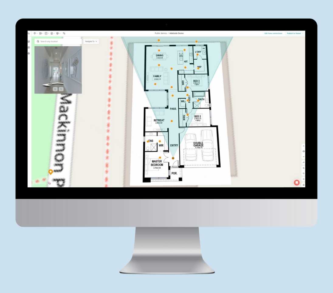
Visualize indoor spaces with stacked floor plans
Add Floor Plans for multi-level spaces
Upload building-level floor plans and position them on your map. Stack multiple levels so users can seamlessly switch between floors in the Swyvl Viewer.
File Types: .jpg and .png
How to add: Upload and align to the map
Best for: Buildings, multi-storey structures, indoor layouts
Switch between floors in the Viewer for easy navigation inside buildings.