Share heritage scans and documentation with anyone, anywhere.
You capture extraordinary 3D records of heritage sites. But your stakeholders — councils, trusts, archaeologists, the public — can't open the files. Swyvl lets them view everything in the browser.
For agencies and councils
Manage a portfolio, not just a project.
One workspace. Every listed building on a map. Decades of restoration documentation captured under one roof — with the audit trail government compliance and grant reporting requires.
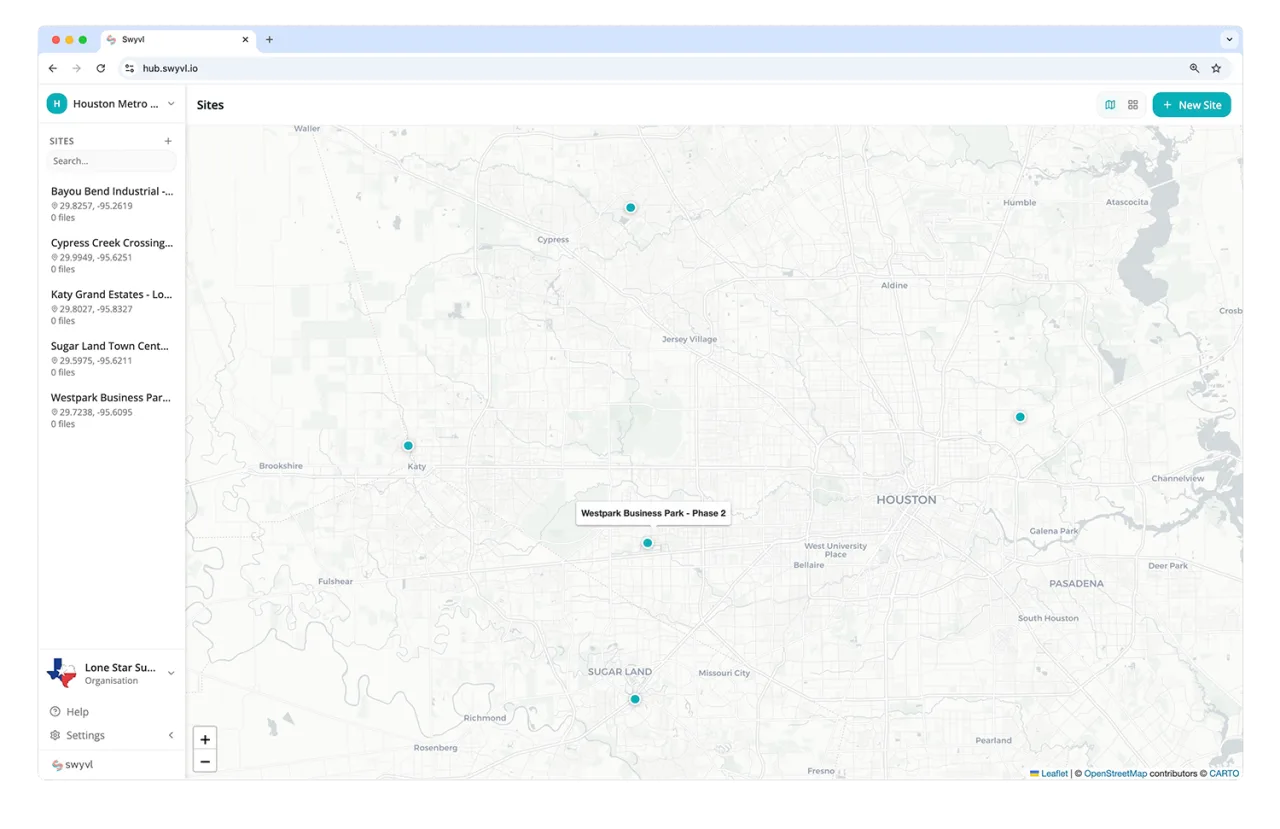
Multi-site portfolio map
All your listed buildings as pins on one map. Click any site to see its capture history, condition reports, and restoration record — across an agency's entire portfolio.
Before/after restoration timeline
Each capture session is time-indexed. Compare a facade pre- and post-restoration, document conservation milestones, and produce evidence trails for grant acquittal.
Public sharing for tourism & education
Open a site to the public for tourism, research, or interpretation. Branded links viewable in any browser — no specialist software required for the visitor.
GIS-ready
Upload GeoTIFF orthomosaics and shapefiles of heritage boundaries alongside your scans. Viewable as interactive map overlays — no specialist GIS workstation required.
Immutable audit log
Every upload, share link, and viewer access is logged with timestamps and identity. Defensible records for government compliance, grant acquittal, and tribunal evidence.
Sovereign data residency
Heritage records often fall under government data sovereignty rules. Choose your storage region at setup — Australia, UK, EU, US, Canada, Japan, or Singapore — and your data never leaves it.
Spatial data is transforming heritage preservation
LiDAR, photogrammetry, and 360 imaging create permanent digital records of buildings, landscapes, and artefacts. The challenge is making these records accessible.
Documentation and conservation
Record the current state of a heritage building or site with millimetre-accurate LiDAR scans. Share the resulting point clouds with conservation architects, structural engineers, and planning authorities — all through a browser link.
Point cloud viewer with measurement tools
Photogrammetry models
Deliver textured 3D models of facades, sculptures, archaeological finds, or entire structures. Stakeholders rotate, zoom, and inspect the model in the browser — no 3D software required.
3D model viewer for OBJ, glTF, PLY
360 virtual tours
Capture equirectangular panoramas of interiors, excavation sites, or restricted-access areas. Share immersive 360 views with stakeholders, researchers, or the public through a simple link.
Spherical panorama viewer
Site mapping and GIS
Share GeoTIFFs of archaeological site plans, orthomosaic surveys of landscapes, or georeferenced historical maps. Viewers see them as interactive map overlays they can zoom and pan.
GeoTIFF map overlay viewer
Make heritage data accessible to every stakeholder
Heritage projects involve diverse stakeholders — local councils, heritage trusts, architects, academics, community groups. Most don't have specialist software. Swyvl gives each group access to the data they need through branded links.
-
No account required
Stakeholders open a link and view the data immediately. No sign-up, no software download, no friction.
-
Branded presentation
Customise links with your organisation's branding. Present heritage data with the professionalism the subject matter deserves.
-
Access tracking
Know who viewed the data and when — useful for grant reporting, project governance, and stakeholder engagement records.
Data residency matters for heritage
Heritage data often falls under government data sovereignty requirements. Choose from 8 storage regions — your files stay in the jurisdiction you select.
Australia
Sydney
US East
Virginia
US West
Oregon
United Kingdom
London
Europe
Frankfurt
Canada
Toronto
Japan
Tokyo
Singapore
Singapore
Make heritage data accessible to everyone who needs it
Free for up to 5 GB of storage. Upload your first heritage scan and share it with stakeholders in minutes.