Every scan, every survey, every site — one organised record.
Mining operations generate enormous volumes of spatial data across dozens of sites. Swyvl organises it all by location, makes it viewable in the browser, and delivers it to the right people without a Dropbox link in sight.
Your mine site data deserves better than a shared drive
You capture the data. Then it sits in a folder no one can navigate — or worse, a Dropbox link that expires.
Stockpile surveys sit in folders on a shared drive. No one can find last quarter's scan.
Survey data piles up in nested folders with inconsistent naming. Finding a specific capture from six months ago means asking whoever did it — if they still work there.
Every capture organised by site and date. Find any survey from any period in seconds.
Swyvl organises every upload by site location and capture date. The full survey history of any location is one click away — no folder archaeology required.
Your contractor sends a LAZ file. Your engineering team doesn't have CloudCompare.
Point cloud data reaches your engineers as a raw file they can't open. They raise an IT ticket. The IT ticket sits unresolved. Everyone waits.
Browser-based point cloud viewer. Your team opens the scan in Chrome. No software, no IT ticket.
Swyvl uses Potree WebGL to render LAS and LAZ files in any modern browser. Your engineers see the scan in 60 seconds — rotate, pan, zoom, no install required.
You have no audit trail of what data was delivered to which stakeholder and when.
Shared drive links and email attachments leave no record. When a regulator or auditor asks who received the data and when, you have nothing to show them.
Every portal view logged — who opened it, when, from where. Full compliance-grade audit trail.
Swyvl logs every portal access event — user, timestamp, device, IP, and download actions. Exportable. Retained for up to 2 years.
Built for mining operations
From stockpile volumes to geotechnical documentation — every use case covered.
Stockpile volume monitoring
Upload drone survey outputs after every volumetric flight. Compare captures across time. Deliver results to site managers via a single share link.
Pit progression tracking
Time-indexed point clouds of pit development. Each survey adds a layer to the site record — viewable side-by-side or independently.
Contractor delivery management
Surveyors upload direct to your workspace. You control access. Stakeholders get a browser link — no raw files, no software requirements.
Geotechnical documentation
LiDAR scans of highwalls, waste dumps, and underground headings. Stored with full metadata, shared with geotechs and engineers via secure portal.
Compliance and audit records
Immutable, time-stamped records of site condition at every survey date. Full audit trail. Regional data residency for compliance.
Multi-site visibility
All your sites in one workspace. Switch between operations, compare survey dates, and manage contractor access — from one dashboard.
Swyvl handles every format your surveyors produce
Upload it. Swyvl classifies it and picks the right viewer automatically.
In practice
The 3D capture company Swyvl grew out of, delivering to mining and energy clients
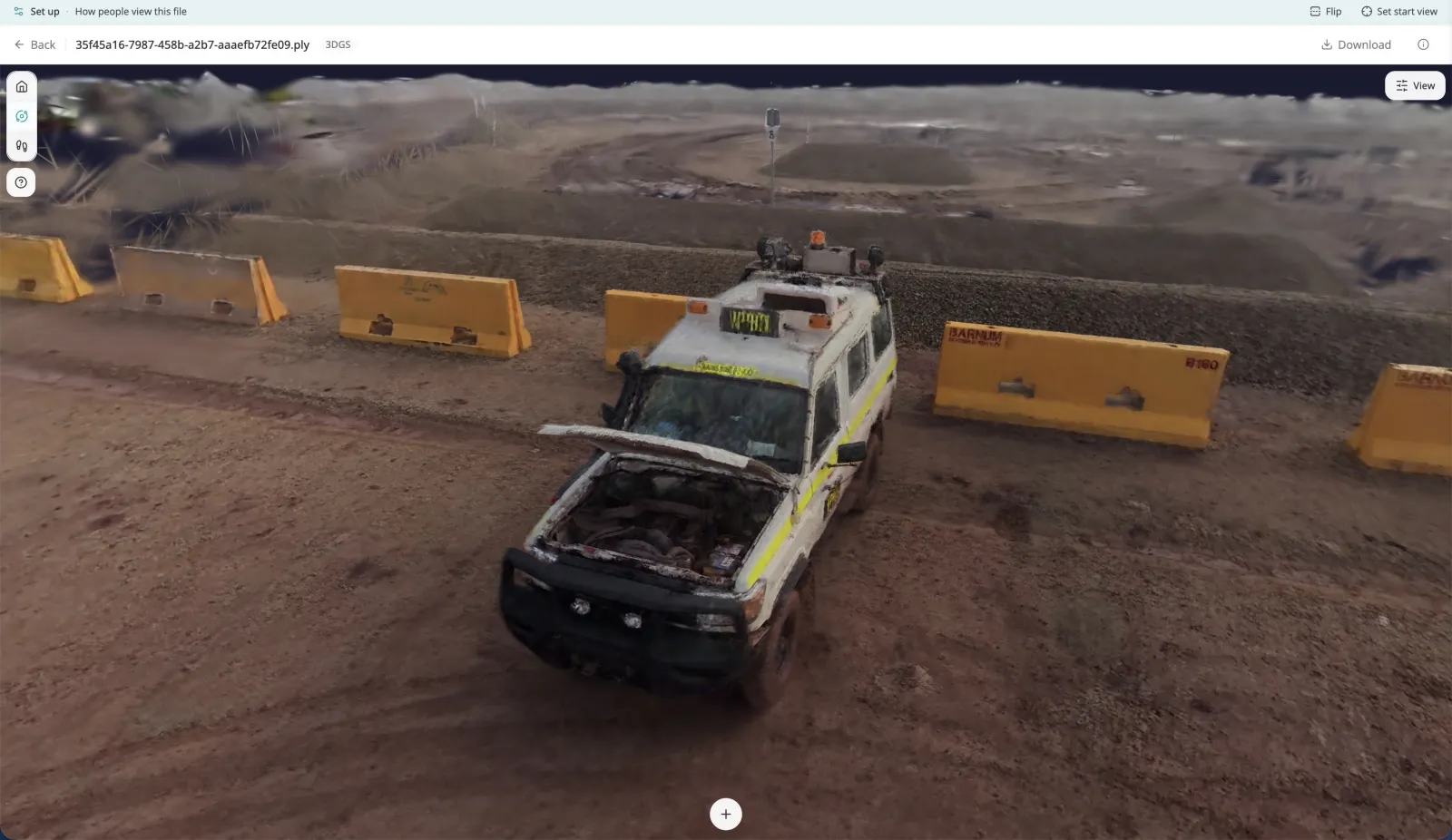
360° video walkthroughs and Xgrids Gaussian splats of plant and pit, delivered on one branded link per site. A site manager opens it, walks the capture at eye level, and checks a clearance without installing anything.
A real Swyvl account. Name withheld.
Your mine site data deserves better than a shared drive.
Free to start. No credit card required.
Frequently asked questions
Everything mining teams ask before switching from shared drives.